
The ancient trees around you. The play of light among the leaves. The gradual incline that takes you up to a stunning view or down into a meadow full of flowering wildflowers. Trail runs are fantastic, not least because of the scenery.
Today, searching for running trails near me is easier than ever. But with so many trails nearby, choosing the next one can be overwhelming.
Read on for tips on how to choose a running trail near me and the best apps for finding trails.
In This Article
In This Article:
Things to Consider While Choosing a Running Trail
When searching for running trails near me, take a moment to filter through your options. In many areas, you’ll get plenty of established new trails, together with variations on them. Jumping on the first trail isn’t always the way to the best experience, though.
Here’s what you need to pay attention to when selecting the best running trails near me.
Your fitness level
Trail runs range in difficulty from easy to grueling. Being fit and enthusiastic about running doesn’t mean you should push yourself too hard too soon.
Trail running is meant to be fun. It should also be challenging, granted. But not to the point that you grind your teeth through the run.
Start with easy to moderately difficult trails that can challenge you while remaining fun. This way, you’ll stay motivated to keep on going and experience incremental gains faster than if you were to give everything you have during the first run.
Available running time
Do you have half an hour, an hour, or more than an hour to spare? Factor in the time it takes you to reach the running trail.
Having to drive there or use public transportation can more than double the time you need. It’s better to give yourself a wider time margin than let darkness catch you on the trail.
Tip: It’s not a good idea to run trails late in the day as a beginner runner. Running in the dark increases your risk of accidents and serious injury, even with proper equipment.
Elevation gain
Hills or steep segments can make a trail run much more demanding. Choose a manageable trail elevation. When tackling a high-elevation trail, consider reducing your running time.
As a beginner runner, elevation may not seem like much. But in actual practice, steep terrain can be very challenging.
A safe approach is to start with flat or low-elevation trails and then gradually increase the elevation. With experience, you’ll learn how much elevation gain you can handle on a trail and for how long.
Weather and season
Running in the torrid heat of summer can make an easy trail more difficult. Cold, wind, dust, rain, snow, ice, or high humidity can up the difficulty of any trail.
Always check the weather forecast to make sure you’re properly equipped before starting your run. Have a weather app with you to get any emergency notifications, such as for unexpected thunderstorms.


The weather and season will also determine the availability of trails. Some trails will still be covered in snow in early spring, making them inaccessible.
Plan in Advance and Have the Necessary Gear With You
Many trails will start in one place and finish in another. That calls for a bit of planning since you may have to switch cars, take a bus or train, or get a lift back to your starting location or home.
It’s better to plan this before the run. In some areas, you may experience problems with cell service. Buses or trains may only run between certain hours or be far in between.
You also want to plan hydration and other necessary supplies. Taking enough water with you is essential for every trail run. Longer runs also call for an energy boost in the form of a trail mix, healthy snack, or runners’ gel.
Getting enough supplies with you without stopping during the trail run may require additional equipment. For example, a running vest or a running backpack.
Lastly, make a list of all the running gear and other supplies you need to take with you. These may include:
- Trail running shoes
- Running shorts or tights
- Running top or shirt
- Windbreaker
- Gloves
- Hat
- Sunglasses with UV protection
- Buff bandana with UV protection
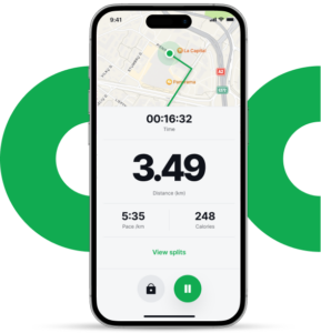
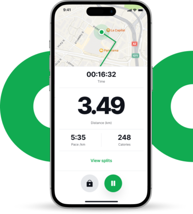
- GPS running watch
- Hydration pack
- Headlamp
- Headphones
Find Running Trails Near You With These Apps
There’s no shortage of apps that promise to help you find the best running trails near me. But some apps have more features and provide a better user experience than others.
To save you time, we’ve scoured the web and app stores for the best trail-running apps available. Finding a running trail near me with these apps gets so much easier.
AllTrails
AllTrails is one of the best-known trail-running apps on both the App Store and Google Play. After a quick registration process, it suggests trails based on your location.
You can filter thousands of trails based on length, duration, difficulty, elevation gain, attractions, and other factors. Users’ trail ratings and comments can help you decide whether a trail is right for you. You can also check trail images.
The free version of the app has ads and won’t let you download maps for offline use. Even so, it remains one of the most compelling apps for finding trails to run near me.
Highlights
- Over 300,000 trails in 190 countries
- Over 30 million registered users
- Free basic membership offers access to all trails
- Pro plan starting at $29.99/year with offline map access
- Lifeline location monitoring safety feature available (Pro plan)
Grab AllTrails on Google Play or the App Store.
Trail Run Project
The Trail Run Project is a free, crowd-sourced trail database that features predominantly US-based trails added by an active community of runners. It enables you to sort trails by state, a handy feature if you enjoy traveling throughout the US.
When you’re traveling internationally, you can filter trails by country, easily find top runs and add them to your favorites list.
You can refine results based on difficulty level, distance, elevation gain, rating, type, and even dog-friendliness. The latter is a filter not every trail-running app offers.
Highlights
- Over 258,000 miles of running trails
- Over 79,000 trails
- You can download trails for offline use
- You can add your favorite trails
- Full GPS route info
- Detailed topographical trail maps
Grab Trail Run Project on Google Play or the App Store.
Strava
A favorite among runners and cyclists, Strava does more than record activities and provide analytics. It can help you discover trails close to your location as well as explore trails in new places.
Marketed as a social network for athletes, Strava is powered by a vibrant community of runners. Through it, you can discover new trails and compare your performance against other runners.
Unlike other trail apps, Strava brings a competitive edge to trail running. Especially if you like to share your results in the app feed and on social media.
Strava premium starts at $5 a month and offers leaderboards, personal heat maps, group challenges, weather, grade-adjusted pace, race analysis, and other performance features.
Highlights
- Find routes near you
- Draw your own routes with cues from the app
- Explore routes around the world
- Heat maps show you other runners (Premium feature)
- Track your run and get performance insights
- Join local clubs and share your progress on social media
- Over 100 million users
Grab Strava on Google Play or the App Store.
Hiking Project
As the name suggests, Hiking Project is not a trail app for runners per see. But you can use its trail maps to search for running trails near you.
The Hiking Project started as a sister project of the Trail Run Project we’ve already talked about. A free app, it’s powered by an enthusiastic community of runners.
For most runners, the Trail Run Project makes it easier to find routes. But if you want to combine trail running with hiking, you may want to give the Hiking Project a go. It’s simple to use and fun.
Try Joggo for FREE
We combined exercise and meal planning for the most effective way to LOSE WEIGHT.
Highlights
- Over 74,000 trails
- Guidebook-quality trail descriptions and stats
- Full GPS route information with elevation profiles
- Tips and highlights from local experts
- High-resolution trail photos
Grab the Hiking Project on Google Play or the App Store.
TrailLink
With TrailLink, you can discover trails near you as well as explore trails in other locations. Curated trail guides for popular locations make the app appealing to beginners.
Detailed maps and comprehensive trail descriptions with reviews and photos add to its value. Your first map download with TrailLink is free, but after that, you have to upgrade to an Unlimited account for $29.99 a year.
TrailLink shows the surface of trail runs. This makes it handy if you want to find specific trails, such as paved running trails near you.
Highlights
- Over 40,000 miles of curated trail maps
- Trail photos
- Save favorite trails
- Check and post trail reviews
- Guidebook descriptions for trails
- Offline maps (Premium feature)
- Shows which trails are wheelchair accessible or suitable for other activities
Grab TrailLink on Google Play or the App Store.
Gaia GPS
Gaia GPS is a detailed mapping app that can help you explore trails off the beaten path. You can create your own routes in some of the most picturesque and challenging locations in the US.
Gaia GPS is not a dedicated app for trail runners, having been developed for hikers and off-road explorers. But many maps also work for trail runners.
With the free plan, you can access basic maps and planning tools. To enjoy all the maps and other handy features, you have to upgrade. The Premium subscription starts at $3.33 a month.
Highlights
- Works without cell service
- Over 300 maps
- Weather and terrain features
- Record runs
- Trail guides curated by National Geographic experts
Grab Gaia GPS on Google Play or the App Store.
Supporting Apps for Trail Runners
In addition to apps that can help you search for a trail run nearby, the following apps can also prove useful.
Neveralone+
Neveralone+ lets you share your location with a chosen contact. It can notify them if you stop unexpectedly during your run. To alert multiple contacts, you have to upgrade to a paid plan. In-app purchases start at $0.99.
Grab Neveralone+ on Google Play (not available in the App Store).
Local WX & Dark Sky Powered
Dark Sky provides hyperlocal, close to real-time weather information. Its accuracy, advanced weather maps, and detailed forecasts make it a valuable tool for long runs in tricky weather.
Grab Local WX & Dark Sky Powered on Google Play (not available in the App Store).
Running Trails in the US Worth Traveling for
Want to go beyond trail running nearby and explore some of the best running trails in the US? From forest and beach trails to flatlands and mountain runs, you have many spectacular options to choose from. Discover some of the most striking.
The Winsor National Recreation trail
Located in Santa Fe, New Mexico, this moderate-difficulty trail winds 13 miles through a beautiful national forest. On your way to striking views, you’ll encounter some of the tallest pine trees you’ll ever see.
The Godwin Hill Loop trail
This easy 6.2-mile trail loops through the Konza Prairie Preserve, alternating gentle hills and level surfaces. Run it in the spring to enjoy the colorful prairie wildflowers.
The Awa’awapuhi trail
The Awa’awapuhi trail along Kauai’s Na Pali coast in Hawaii challenges you with a 3.2-mile run through the forest and over difficult terrain. Not the most accessible of trails, but the ocean views from atop the cliffs can make it one of the most memorable runs of your life.
The Art Loeb trail
Located in the Pisgah National Forest in Asheville, North Carolina, the 30-mile-long Art Loeb trail may seem an endless joy. You don’t have to run it all in one go, though.
The trail is broken into several sections you can tackle one at a time. Ideal for a multi-day trail run with rests in between.
Dipsea trail
Grassy meadows with ocean views and lush forests with giant ferns and redwoods are just some of the highlights of this 7.4-mile run through Marin County in California. It’s not an easy run, but all that natural beauty more than justifies the effort.
Other Trails You May Want to Consider
- Appalachian Trail, Georgia to Maine. Take your pick of any section from this staggering 2,190-mile trail.
- Mesa Trail in Boulder, Colorado. 6.7-miles long. Difficulty: moderate to hard.
- Ocean Path Trail in the Acadia National Park, Bar Harbor, Maine. 2.2-miles long. Moderate to hard difficulty.
With so many trails around, going beyond running trails near you can bring you some of the most memorable runs in your life. Try out at least some of them!
References:
- de Waal, S.J., Gomez-Ezeiza, J., Venter, R.E. and Lamberts, R.P., 2021. Physiological indicators of trail running performance: a systematic review. International Journal of Sports Physiology and Performance, 16(3), pp.325-332.
- Viljoen, C., van Rensburg, D.C.C.J., Van Mechelen, W., Verhagen, E., Silva, B., Scheer, V., Besomi, M., Gajardo-Burgos, R., Matos, S., Schoeman, M. and van Rensburg, A.J., 2022. Trail running injury risk factors: a living systematic review. British journal of sports medicine, 56(10), pp.577-587.
- Garcia, M.C., Gust, G. and Bazett-Jones, D.M., 2021. Tibial acceleration and shock attenuation while running over different surfaces in a trail environment. Journal of Science and Medicine in Sport, 24(11), pp.1161-1165.
- Easthope, C.S., Hausswirth, C., Louis, J., Lepers, R., Vercruyssen, F. and Brisswalter, J., 2010. Effects of a trail running competition on muscular performance and efficiency in well-trained young and master athletes. European journal of applied physiology, 110, pp.1107-1116.
- Chase, A.W. and Hobbs, N., 2023. Ultimate Guide to Trail Running: Everything You Need to Know about Equipment, Finding Trails, Nutrition, Hill Strategy, Racing, Avoiding Injury, Training, Weather, and Safety. Rowman & Littlefield.